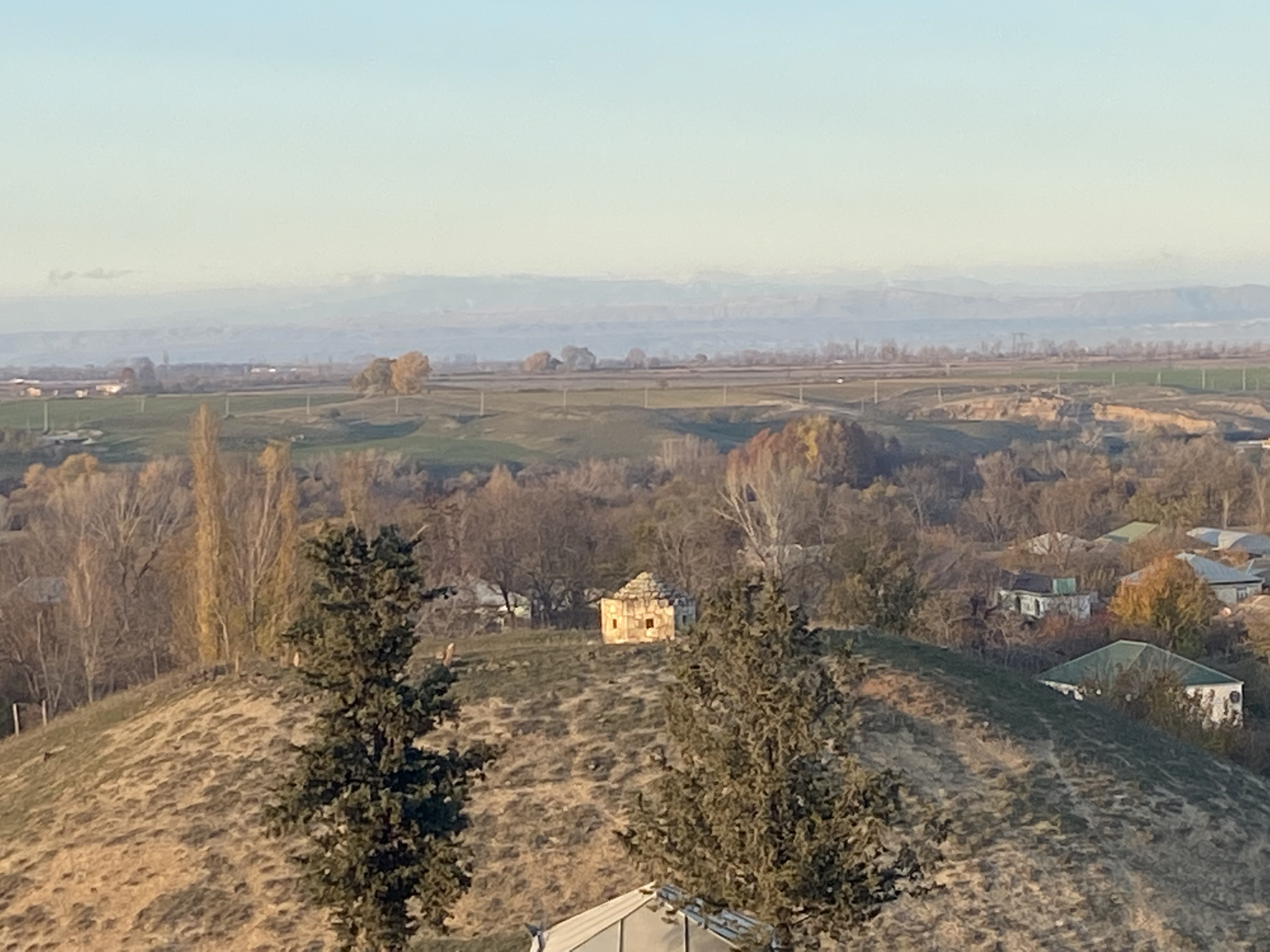
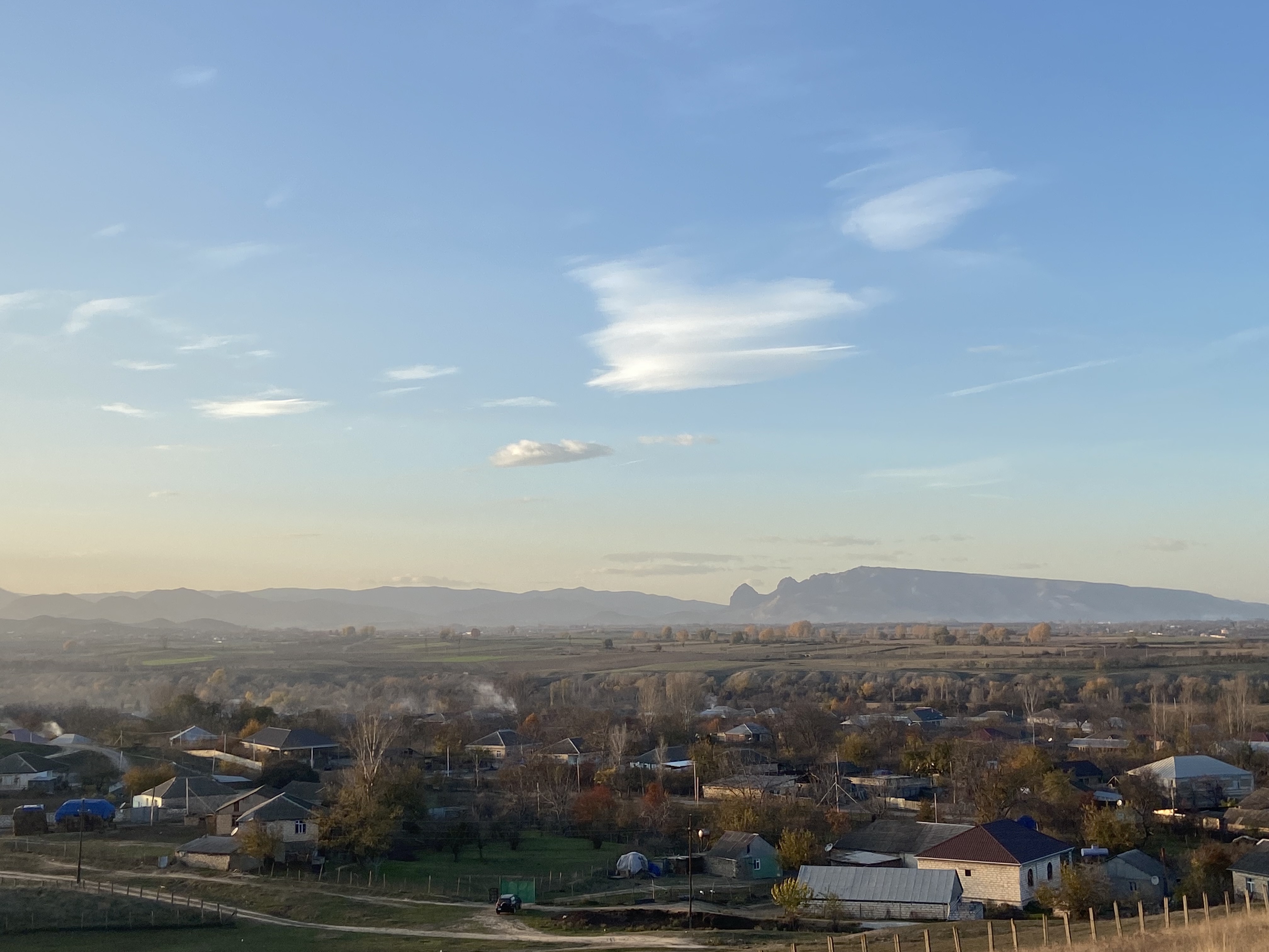
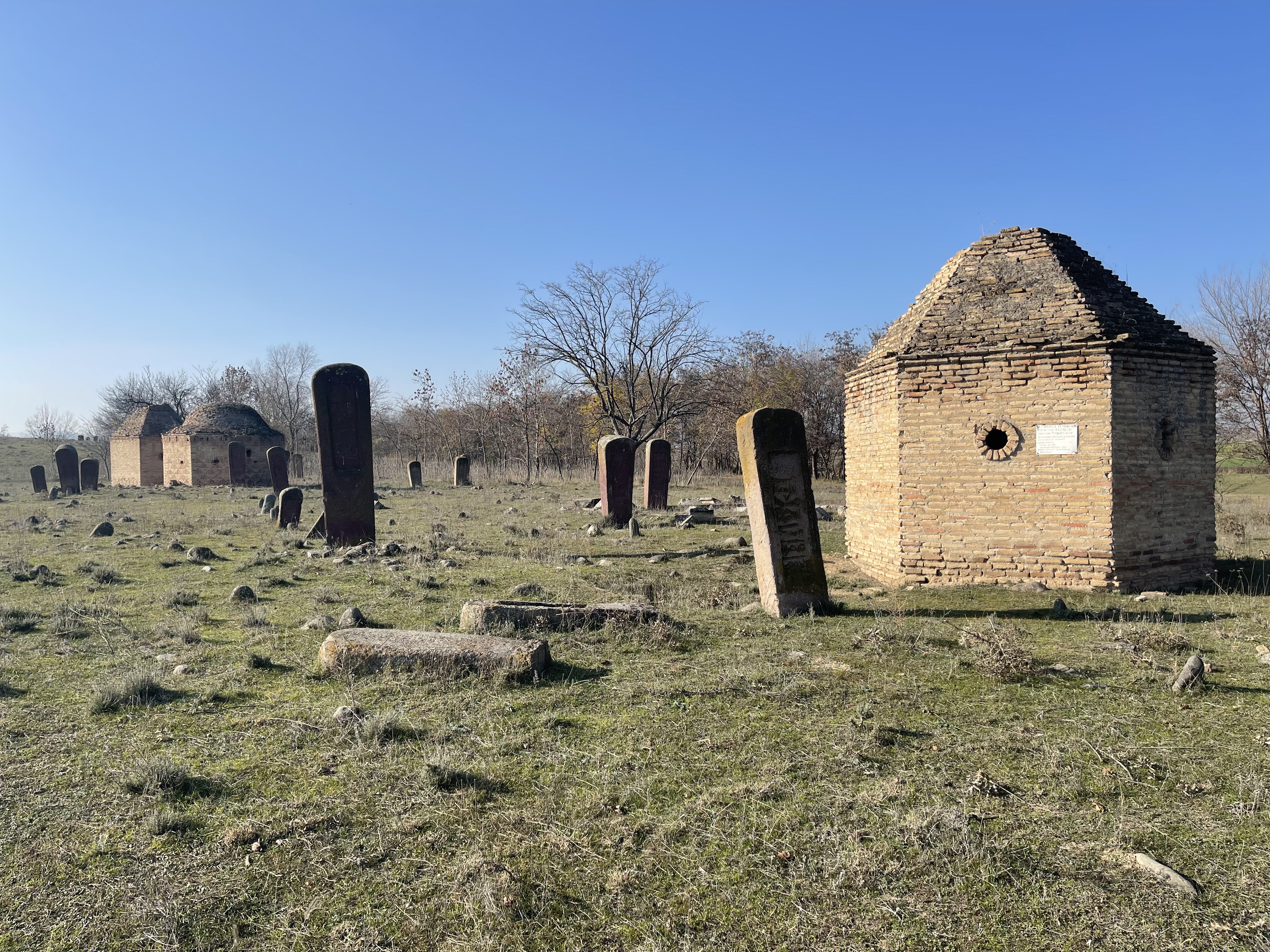
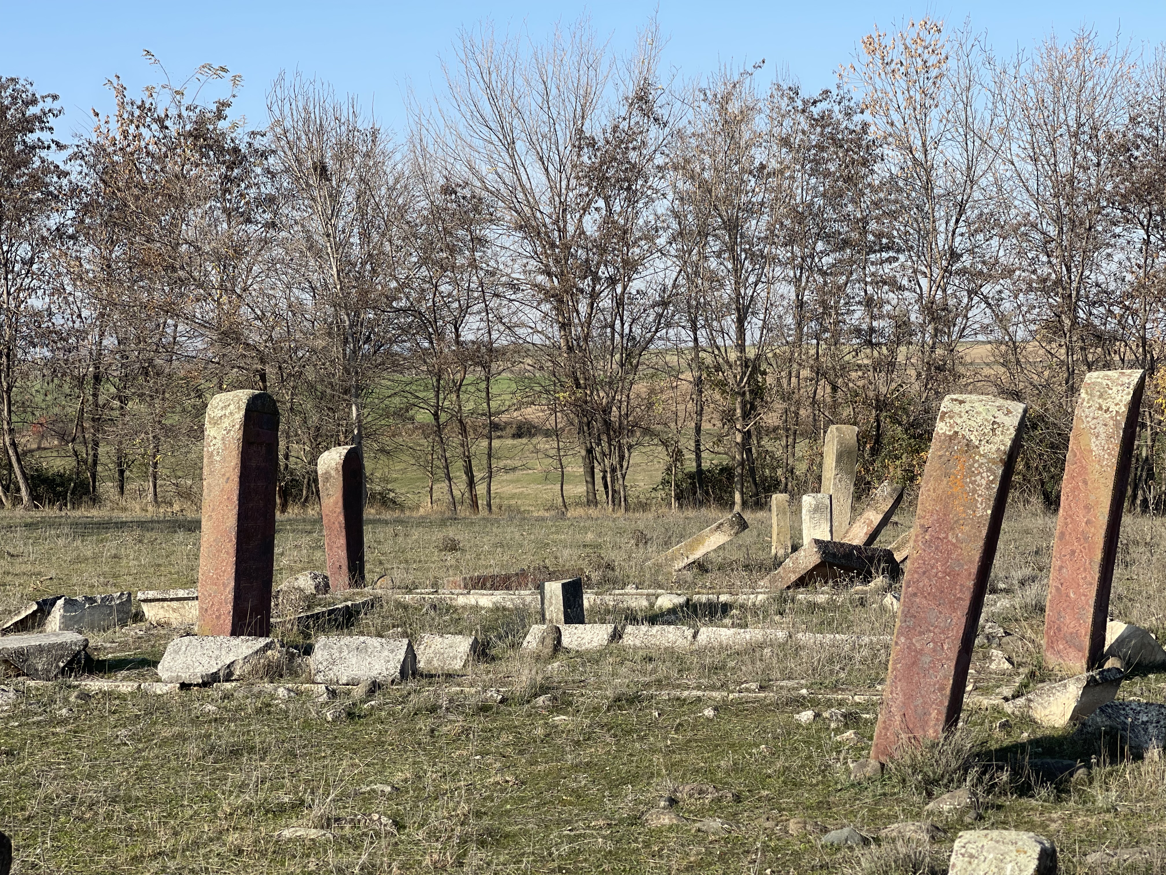
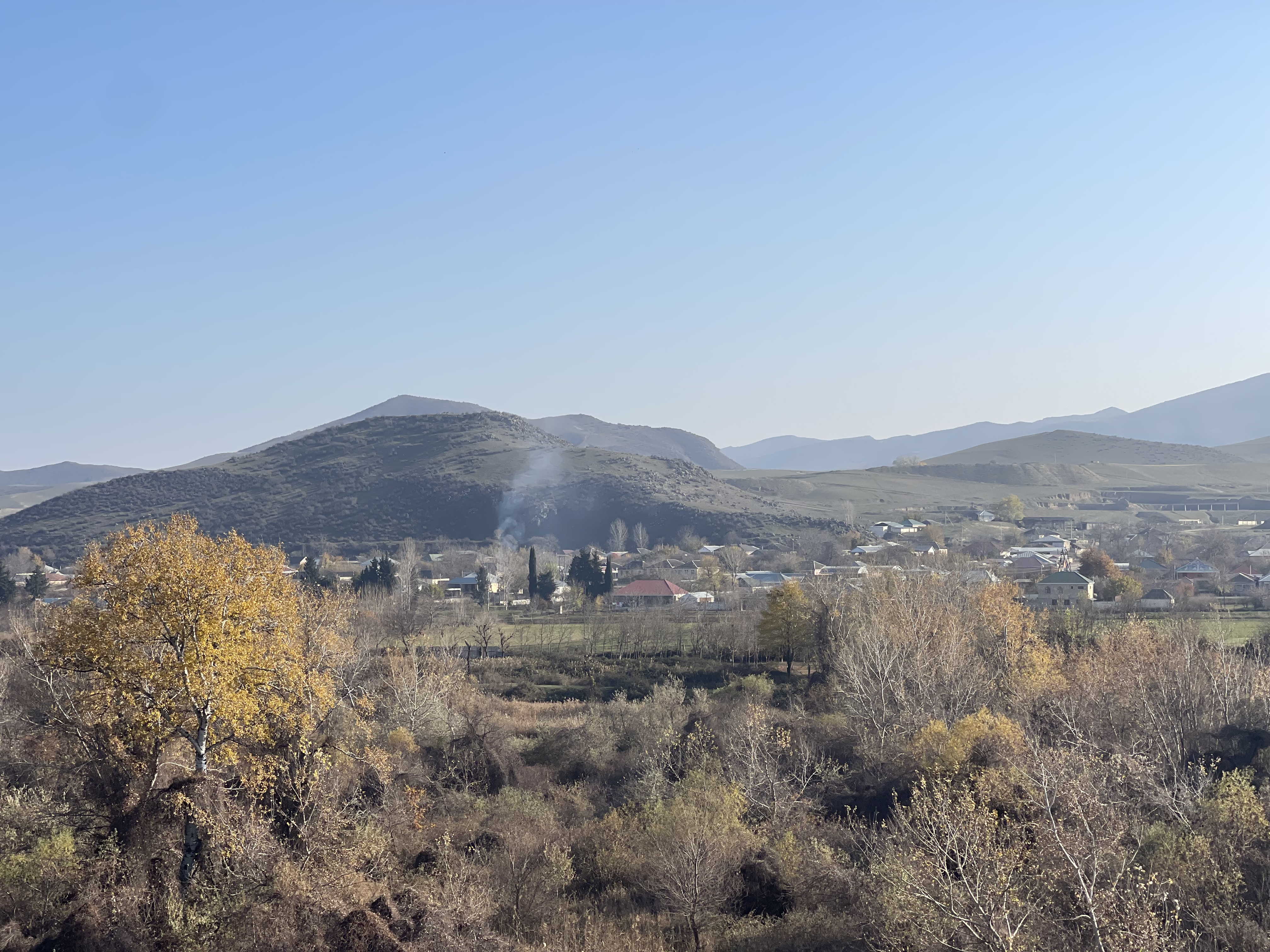
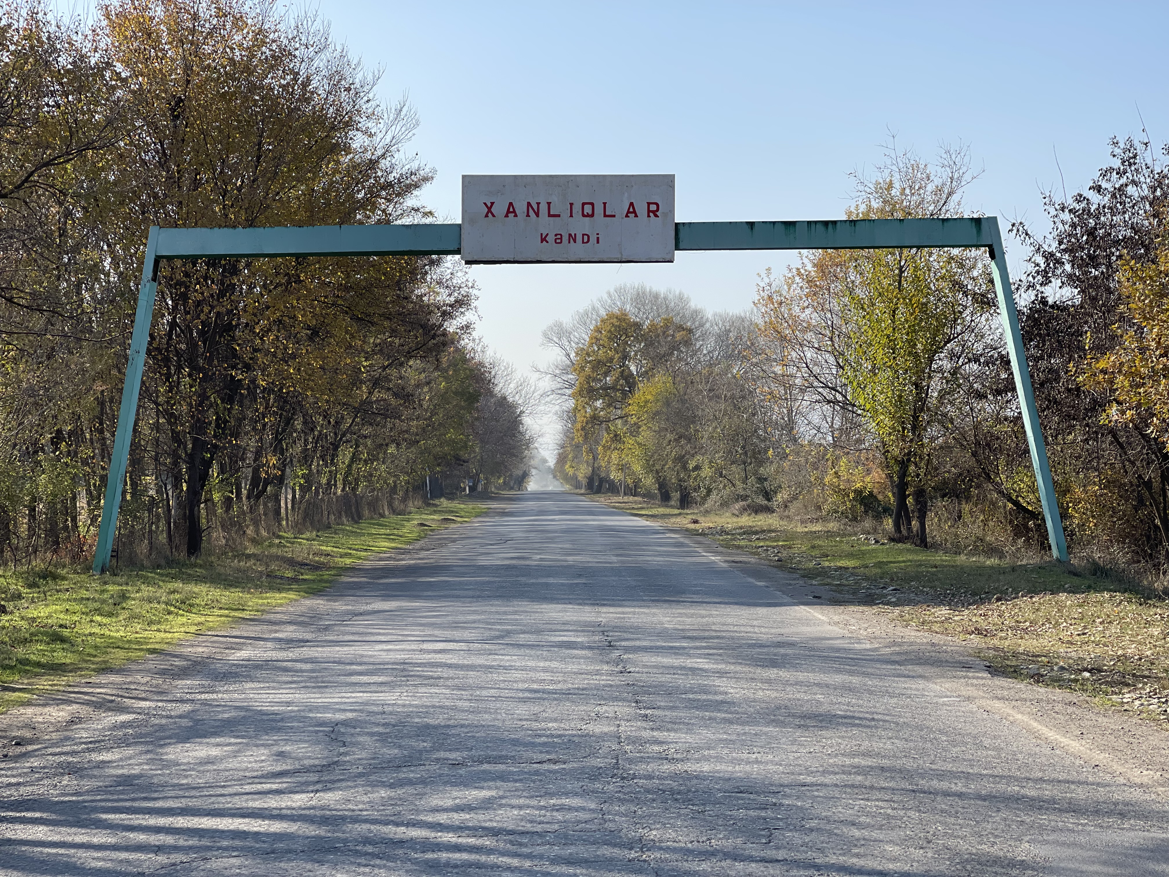
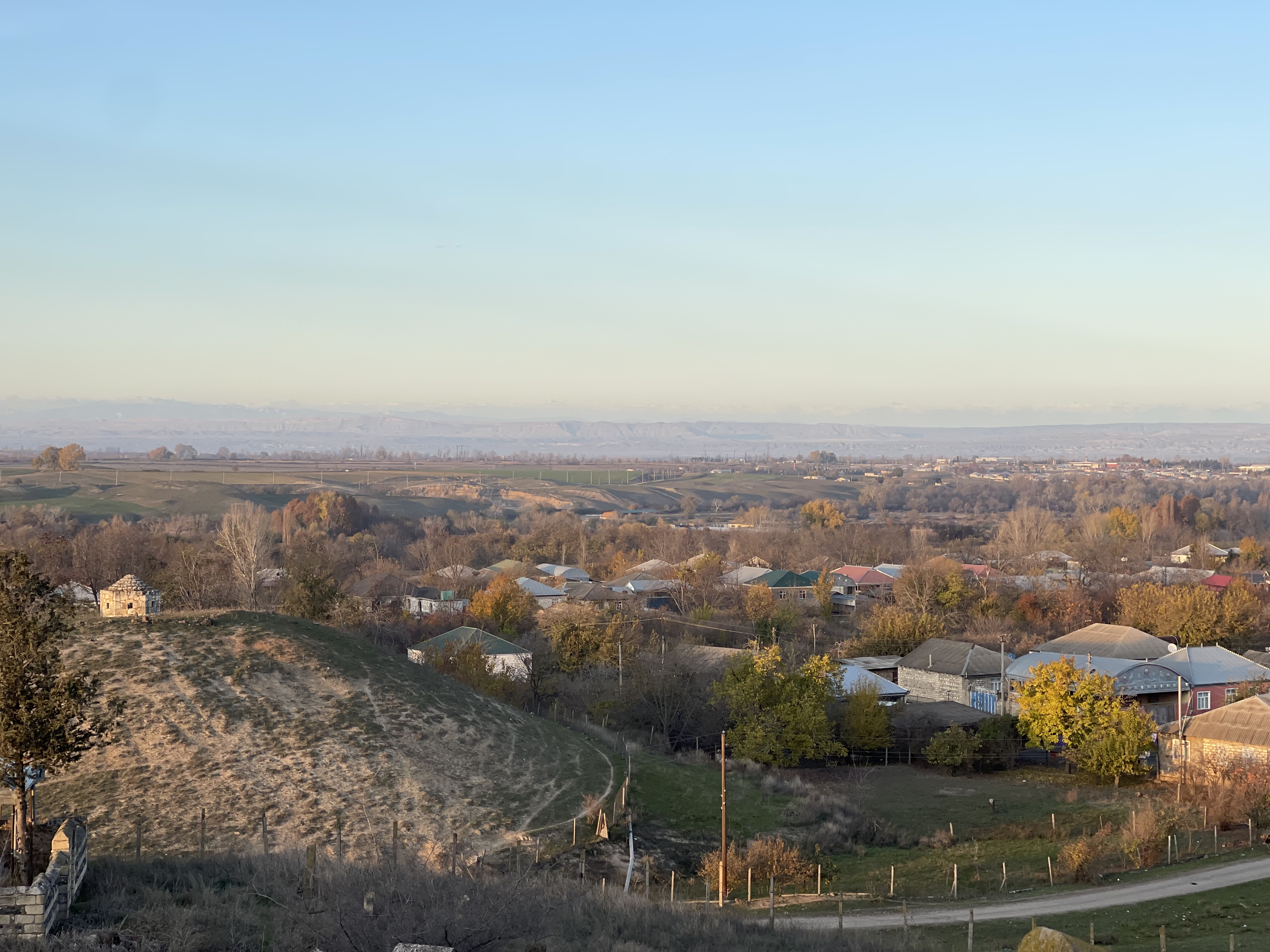
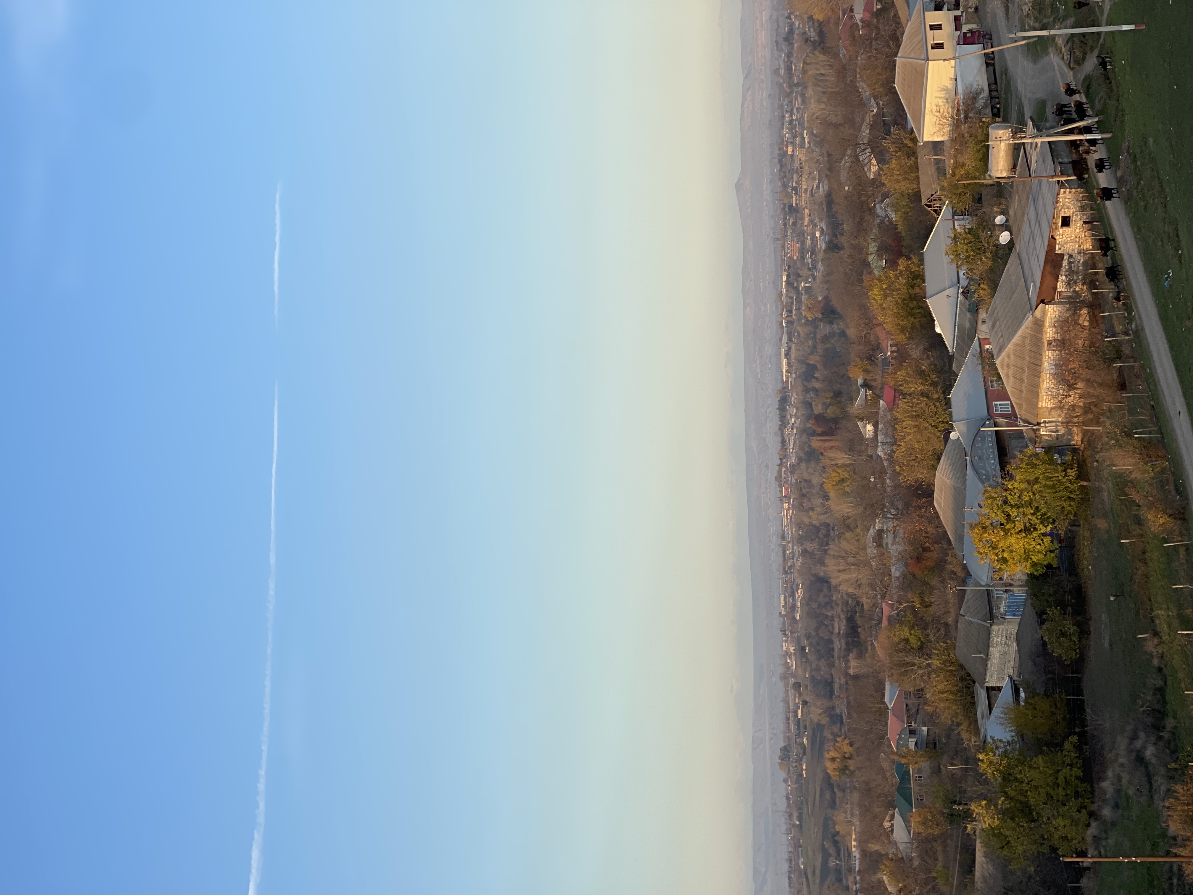
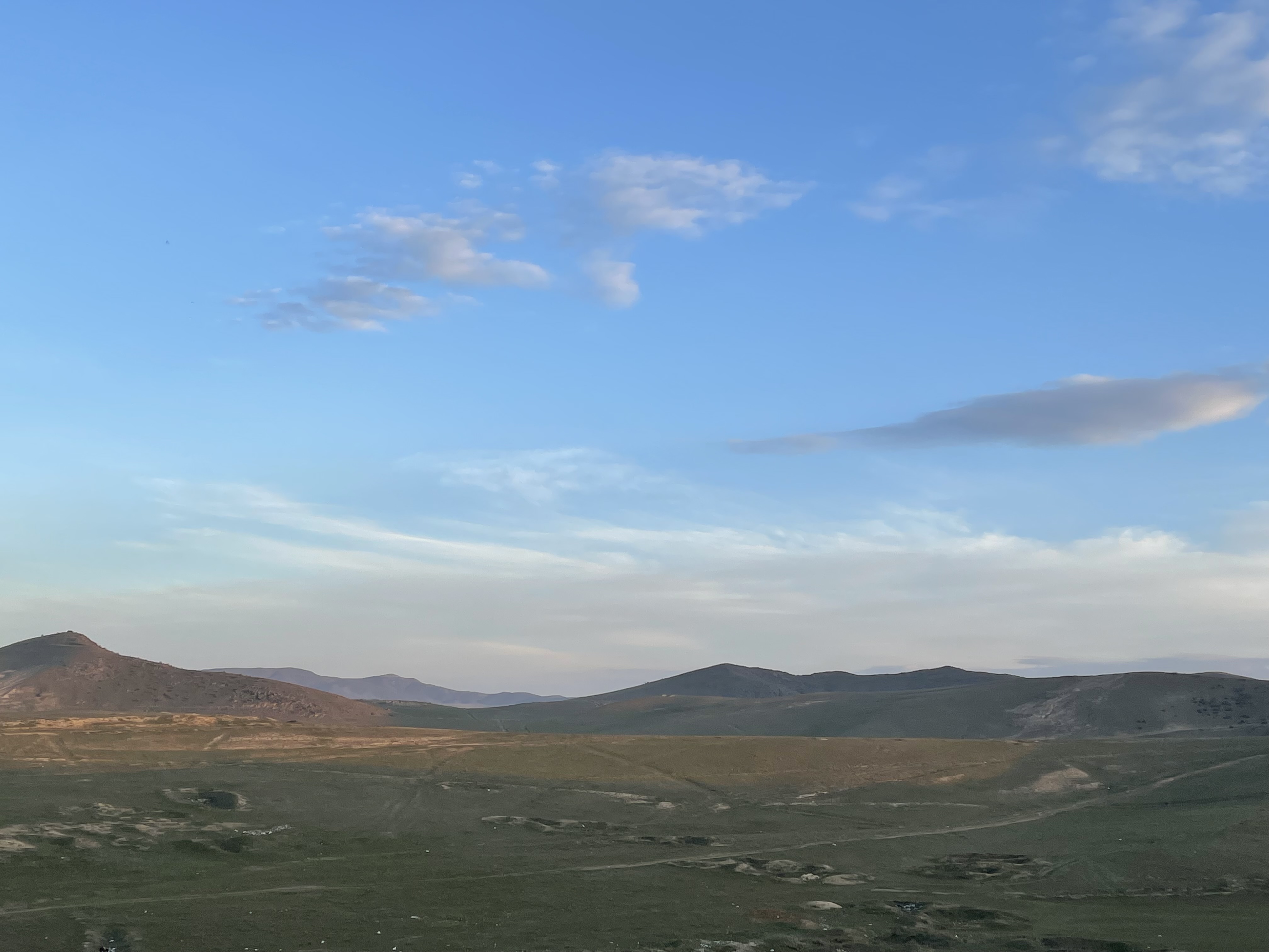
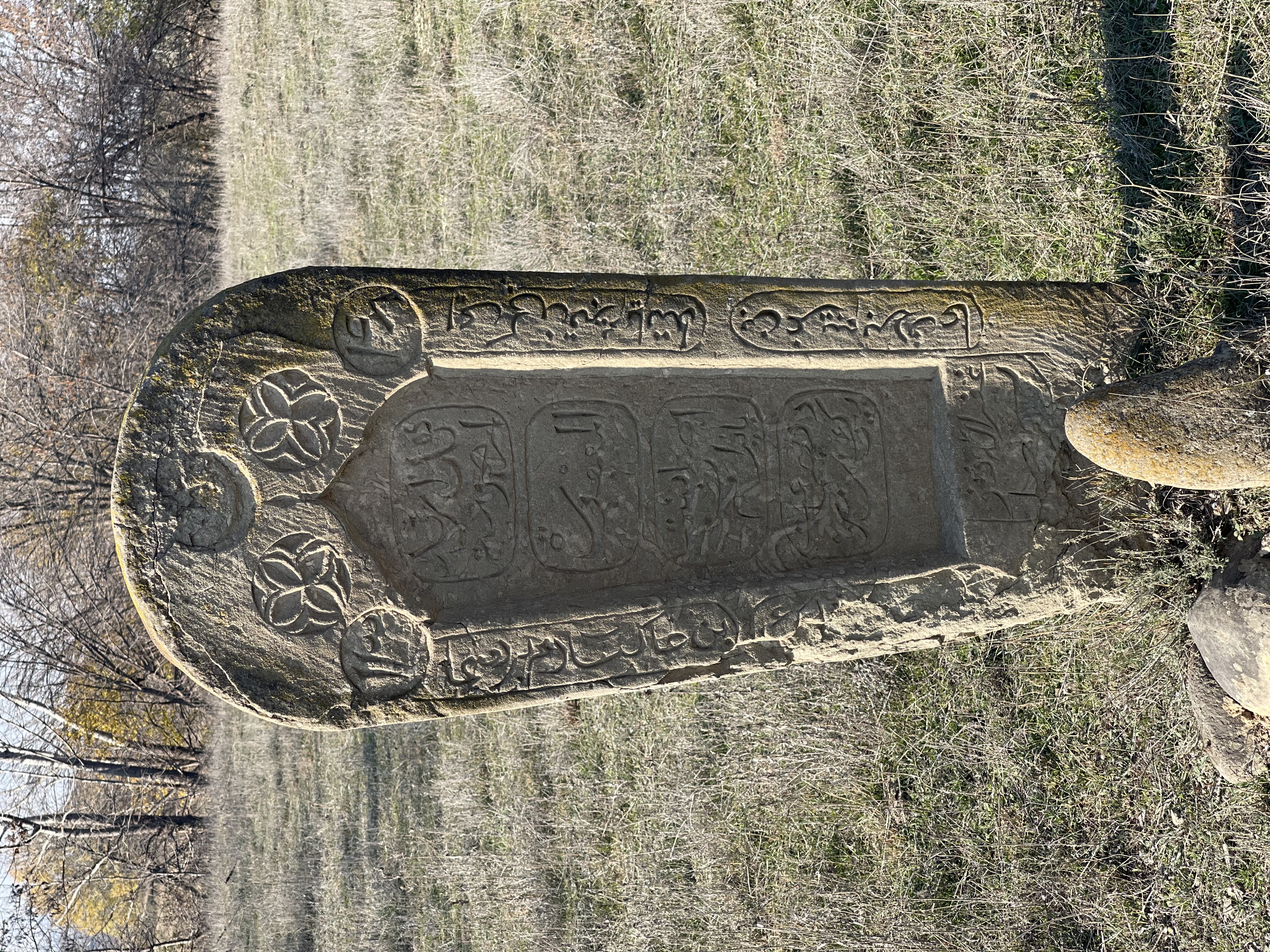
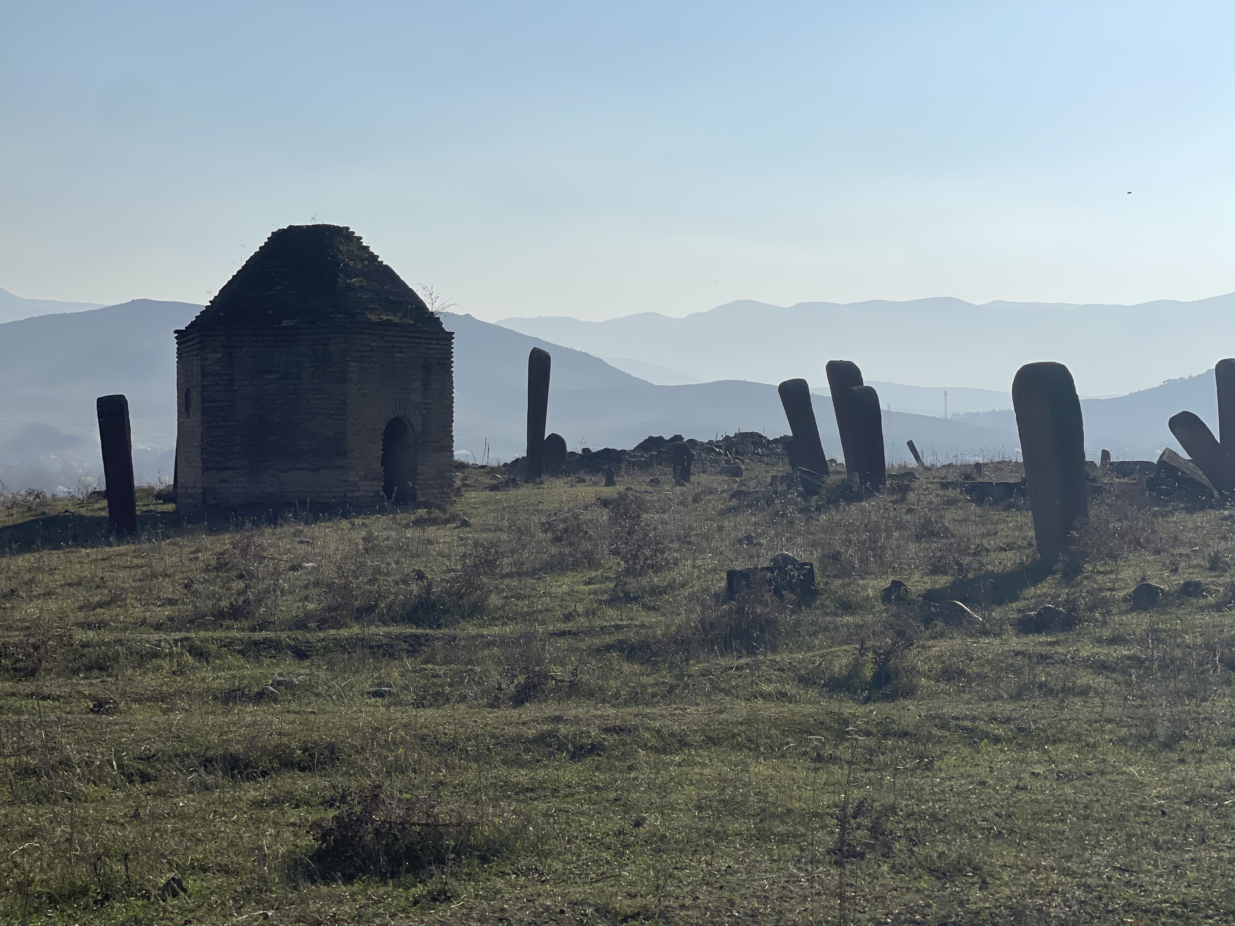
This settlement, which we know as "Khanlyklar" and whose name has historically changed from time to time, is one of the ancient Turkish settlements of the Kazakh House (Kazakh Sanjak, Gazakh Livasi, Gazakh Mahaii). This village, whose arable land belonged to the Dilbazi lords during the khanate and tsarist era, is now living one of its most beautiful times. During the archaeological excavations conducted in this area, an archaeological monument consisting of stone box graves and jar graves belonging to the Iron Age (8th-6th centuries BC) was discovered near the village. During these studies, gray and black vessels, iron spearheads, etc. were also found. local and imported products were found. Undoubtedly, the area inhabited by the Khanate community in the past centuries - between the Jogaz(an) and Agstafa rivers, called Babadarvish after the tomb of Babadarvish, which has been of great importance from the archaeological point of view since the 50s of the last century, and the finds discovered here cannot be neglected. Archaeologists Prof. I.H. Narimanov and G.S. Ismayilov's archaeological excavations conducted here in 1958-66 revealed three cultural layers. Semi-circular semi-excavated houses from the lower layer of the 5th millennium BC, clay pots, grains, bones, needle, we, various animal bones, etc., circular houses built of mud bricks from the middle layer of the 3rd millennium BC, geometric patterns and bird images polished black and red clay pots decorated with it is reported that it has been found. In Babadarvish, archaeologists have found quadrangular houses, household wells and jars, various household utensils, clay seals, braziers, bronze arrowheads, bull figurines, iron products, etc. from the upper layer attributed to the end of the 2nd millennium and the beginning of the 1st millennium. they discovered. The findings showed that the oldest inhabitants of this place were familiar with farming, animal husbandry, weaving, metalworking and some other arts. The lower layer belongs to the Shomulutepe culture, the middle layer to the Kura-Araz culture, and the upper layer to the Khojaly-Gadabey culture. The territory of this village, located on the ancient trade route from Tiflis and Shamkir to Gazag, and from here down the Dilijan gorge to the Iravan hollow, which rests on the Kargaya and Valikhan forest on one side, the Didaban ("Didvan") constellation and the Aghstafa river on the other, the remains of the Babadarvish and Didaban constellation, etc. the ancient monuments are mute witnesses of the fact that this place was selected as a large settlement on the said ancient caravan route in the middle centuries. Undoubtedly, the most interesting historical monument of this place is the Didaban ("Didvan") constellation, which dates back to the middle centuries and has remained standing until our time. There are also those who explain Didaba, which is located on a high hill 7-8 kilometers from the Gazakh-Dilican road, as a "watchman's constellation". The height of this circular-shaped mysterious building is 10 meters, and the diameter is about 8 meters. There is a narrow door to enter. The core of this building of the "tower-donjon" type is made of granite pieces and has a truncated cone shape. But at the foot of this constellation, which covers an area of about 8 hectares, surrounded by a settlement that was fenced in ancient times, it is difficult to explain the building in question as a lonely watchtower at this height at the mouth of the stream. As can be seen from the traces of the surrounding city, this constellation is simply the highest point of this ancient settlement whose name we do not know exactly, and the history of the constellation that is standing today is inextricably linked with this ancient settlement whose name is unknown. According to some experts, the building dates back to the early Middle Ages. Of course, archaeological excavations in the area could reveal many things. Another interesting monument is the Tajibey mound. According to folk legends tradition, this mound is connected with a great battle between two armies that took place in this place in the past centuries. A general called Taji Bey died heroically in this war and the soldiers of the victorious army brought a horse bag of earth each and piled it on his grave according to the ancient Turkish custom, and this is how this high mound cone-shaped hill was formed. According to some folk tales, the name of the settlement that existed here in the early days was Little Khalkhal, and the name of the city in the Eskipara valley, It was called Big Khalkhal. 1725-1728 years "Tbilisi province's general ledger. Kazakh and Borchali. In the Ottoman historical source named 1728, the name of the settlement called Khanlikuk in the Akhstav district of the Gazakh Sanjak is not mentioned. But the two other residential areas mentioned here can be assumed to be in the place of the present Khanates. One of them is the village of Chalabi, which is registered in that region of the Gazakh Sanjag, but has no subjects, and the other is the village of Khanlica (also known as Yenice), which still has no subjects. The cultivated land of Çelebi village is 120 days old, and the cultivated land of Khanlijan is 200 days old, indicating that these two settlements are quite large, but the reasons for the absence of subjects remain unknown. In any case, 70-80 years later, the mention of a poet and intellectual named Molla Chalabi as a resident of the village of Khanlyklar allows us to assume that we are talking about that area. But in that historical source, "Ismayil village" is mentioned in Akhstav region. The mention of the names of Shahmali Diyargulu oglu and Ali Molla Khan oglu among the inhabitants of this large village, where 55 families live, allows us to say that the settlement in question is at or near the place of the present Khanate. Ali Molla Khan oglu (or Molla Ali Khanoglu) is the person who met Nadir Khan Afshar and got the nickname "Dilbaz" from this meeting. Official documents of the 18th century do not mention the names of those two villages in Gazakh district, but the existence of a village called Garay or Garayli is mentioned, which is mentioned in the generations of Dilbazis as their ancestral village. As the name suggests, this toponym is related to the name of the Karai tribe that lived in the territory of Gazakh in historical sources. For example, in the July 1750 decree of Tiflis governor Irakli Khan about collecting horsemen from Gazakh, the name of "Garay" is mentioned among the villages of the district. According to that ruling, the people of Garay had to provide 5 horse warriors, and it was about the battles that the Irakli fought with the Iravan Khan and other khans who came to help him around Iravan. Some authors try to explain this ethnonym as "Garayli", others as "Garayli". But in the said document, in the Arabic alphabet, this word is not "Garayli", it is read as "Garayli". For example, although Mirvarid Dilbazi mentions the ancient name of this village as "Garayli", the spelling of this written document from that period does not confirm this. In the beginning of the 19th century, this settlement, which was distinguished by its frequent name changes in the last three hundred years, was already mentioned as "Khanlyk". Towards the end of the 18th century, the small and close hamlets called Karaylı, Çelebi, Ismayıllı, and Khanlıca were gradually joined together and a relatively large Khanliq village was formed on the basis of their lands. The evidence that strengthens this opinion is that at the end of the 18th century and the beginning of the 19th century, in the list of villages of Gazakh district (we have seen several such lists), villages such as Çelebi, Karaylı, Ismayılli, Khanlija (Yenija) are no longer recorded. In the Kargaya district, there are ruins of an unknown village that existed in the middle centuries. It seems that the small villages scattered on both banks of the Agstafa River in this vast area gathered together over time and endowed the villages of Big Khanliq and Small Khanliq in the 19th century. In terms of their ethnic origins, the people of the Khanate are of purely Turkic (Oghuz/Kipchak) origin, like other Kazakh people. As for their religious beliefs, historically they belonged to the Sunni sect of Islam ("Umariyyah teaching"), and in return for the violent spread of Shiism by Shah Ismail and his successors, they managed to preserve their ancestral sects like many Kazakhs and did not convert to Shiism. From the middle of the 19th century, adherence to the Naqshbandi sect began to be observed among the residents of this village, as in other Gazakh-Borchali villages. At the beginning of the 19th century, this administrative unit was divided into two parts, and among the villages of Gazakh district ("distance" in Russian-language documents), we see that they began to be called "Big Khanlyk" and "Small Khanlyk", and in some documents "Upper Khanlyk" and "Lower Khanlyk". In the 60s of the 19th century, when religious affairs were being organized in the Turkic-Muslim regions of the Caucasus, the village consisted of two prixods - the Great Khanates and the Small Khanates, and Molla Ahmad Haji Nabi oglu (born in 1845) and Ismayil Efendi Hamza oglu, respectively, (1823-1869) received the designation of "mollayi-ruhani and imam for the life of the clergy". Both of them were exempt from taxes. After Ismail Effendi's death, 3 sons remained in his country (Osman, Ali and Hamza), but because they did not follow the path of their fathers, they were taxed again and returned to the class of vassals. From May 1865, Haji Molla Ibrahim Ashraf oglu (born in 1825) was also included in the clerical category by the Treasury Chamber of Tbilisi after the request of the mufti. At the end of the century, the mullah of the Great Khanates was Molla Mammad Molla Yusif. In 1901, the Khanate consisted of four villages, and the village mosque was located in the area of the estates of the Dilbazi lords. It is shown that the mosque built by Haji Rahim aga Vahidi was renovated again by his descendant Chingiz aga Dilbazi. At the beginning of the last century, Molla Süleyman Veli oglu (1864-1944) was added to the ranks of spiritual mullahs of the village. Molla Suleiman received his religious education in the city of Darband. In addition, the headstones of 19th century clerics such as Molla Abdulla Haji Nabi Effendi, Molla Muhammad bin Molla Muhammad Jalabi Efendi are standing in the Babadarvish cemetery. As for the administrative management of the Khanlyklar, this village, consisting of two parts, belonged to the Demirchilar village community in the internal division of the Gazakh district from the beginning of the 19th century, and was managed by the Demirchilar starshina. In the 80s of the 19th century, the name of Abdulla Gazi Bayram oglu, a resident of Khanliguk, is mentioned. At the beginning of the 20th century, Amirastan Amirahmed oglu, a resident of Demirchilar, worked as a starshina, and he was at work until approximately the year of Sovietization. During the time of Tsarist Russia, except for the Dilbazovs, the mentioned priests and kokhas, the rest of the clans who lived in the two para Khanates belonged to the serf class ("podatnoye sosloviye") and bore the entire burden of taxes paid to the state. Until the 1930s, the people of the khanate lived in a steppe-village life like other Kazakh villages, and their traditional steppe place was Aggaya. In 1913, the village community began to move from the left bank of the Agstafa river to the right bank to its current location. According to the document "Information on the economic well-being of individual villages of Yelizavetpol Governorate, Gazakh district" compiled by M. Muradov in 1914, the Great Khanates and the Small Khanates are two separate administrative units, Demirchilar, Chakhmagli, Jafarli, Alpout, Abbasbeyli, Urkmezli, along with Taharbeyli, still belonged to the "Demirchilar village community" ("Demurchilarskoye selskoye obshestvo"), and at that time their main occupation remained agriculture and animal husbandry. During a long period of time, the village people, who had no occupation other than agriculture and animal husbandry and closely related carpet-making, began to slowly plant gardens in their yards from the end of the 19th century to the beginning of the 20th century. The peasants mainly planted wheat, barley, corn, millet and rye on the leased land. Although they were already familiar with the cultivation of cotton from technical crops, they were not yet familiar with cocoon cultivation, which was widely spread in other regions of the Caucasus at that time. In 1914, when the First World War started and the Yelizavetpol Tatar Regiment was formed, about 60 young men (mostly nobles) from many villages of the Gazakh district volunteered and the regiment left for the Western Front as part of the "Dikaya Division". It is interesting that in the list of volunteers who joined the ranks of the Yelizavetpol Tatar Regiment, there are no names of residents of the village of Khanliguk, including Beyzada Dilbazi. The riots that began with the dethronement of Tsar Nicholas II in February 1917 and swept the entire empire did not escape the Gazakh district, including the Khanals, and this village also fell into the vortex of complex and contradictory socio-political processes. In May 1918, with the division of the South Caucasus into three states and the de facto control of Nagorno-Kazag by Armenia, the Khanate became a border village with Armenia this time. In this direction, the protection of the border was entrusted to the brave sons of the Khanates. In this area, the customs office formally started to operate. When the democratic republic ceased to exist in Azerbaijan on April 28, 1920, and Soviet power was established, Armenia was still under the rule of the Dashnaks (this power was overthrown at the end of November). During these months, their military forces and armed bandit gangs did not stop sedition in relation to the Kazakh border villages. On June 29, when the village of Khanliguk was shelled by their military forces, the population of the village suffered great material damage and lost people. However, in 1914-1917, the armed gangs led by the Kazakh nobles, including some of the Dilbazov lords from the khanates, caused great damage to the Armenian villages in the mountainous part of the Gazakh province, and killed many people who had practiced terrorism among them, it is frequently mentioned in the archive documents of the police of the Gazakh province. In the first decade after Sovietization, the contradictions that started in 1917 continued in this village, and in the course of this painful process, the centuries old economic structure was destroyed, new economic relations were formed, and in the process, many people, including many people from Dilbazi, were subjected to repressions. The name of the Khanlyklar was changed to Musaköy also coincides with these years. According to one source, after Musa Tariverdiyev, a Kazan Tatar-Bolshevik who worked as a military commissar in Kazakhstan, was shot in 1924 by the fugitive Tat oglu Abdulali, a resident of Chaily, in Jafarli district, the local communists of that time proposed changing the name of the Khanlyklar to "Musaköy", and this the offer was, of course, accepted. Thus, during the Soviet period, this village was known as Musaköy and was put on the maps with this name. Based on the confirmation of the knowledgeable people of the village, the Khanate had to change their place of residence several times in this circle. It can be said that this is related to the desire of the rural community to choose a more favorable economic position. This is also confirmed by the presence of cemetery plots in five places around the village. It is said that the ancestors of the village community lived on the left bank along the Agstafa River - on the Babadarvish hills until the 18th century. It covered the area from the village of Demirchilar to Babadarvish in the direction facing Ave from Did-van constellation. The ruins of the old village mosque still remain in that area. From the beginning of the 19th century, when the village was called the Little Khanate and the Big Khanlyklar, it was settled on the lands of the Aghstafa River above the area where it is now settled. The tendency of the village community to the present place belongs to the Soviet period. People left their inconvenient backyards located on dry land and gradually moved to places near water banks and ditches, planted gardens, built beautiful white stone houses, and the village was gradually covered with greenery. Apart from the Dilbazoguls, among the historically formed neighborhoods and numerous roots of the village, there are Jirdakhanli (previously they settled in the damya lands in Didaban district), Tarishli (they are also called Darvishli, but in old documents this name is written as Tarish/Tarishli), Bayramals, Garakhals, Vemellis, Shahbazli, Gorchus, Eyvazali and others can be shown. The people at the root of these generations are the people of the XVII-XVIII centuries. As far as we know, it is now impossible to trace generations before him genealogically. For example, I am at the root of the Hevemellis, who are known as halal people in the village. Heveme Karim oglu lived in the 18th century. The line after him is this line: Humbat - Vali - Suleiman and his descendants. The village community knows how to burn the grave of Vali Humbat oglu, they go to visit and light candles on it. We also visited this grave. On the headstone of the grave is written: "Coban Vali Hamisə oglu". The date of his death is 1286 (1869). As we have already mentioned, in this village, the lands of which belonged to the Dilbazi landowners during the Xanq period and after the land reform of 1846, there are only a few families from the Dilbazi lineage, mainly the descendants of Osman aga's son Bahadur Dilbazi, Hajikarim agha Hajikarim agha Dilbazi and families of their distant relatives live. It is reported that the rest were forced to settle in areas outside the village after the socio-political processes of the 1920s and 1930s. In the archival documents about the past of the village and the farming areas of Dilbazi lords, the following toponyms related to this village are frequently found: Khanliqs, Big Khanliqs (Upper Khanliqs), Small Khanliqs (Lower Khanliqs), Karaly, Ismailli, Jafarli, Chakhmagli, Uzun tala, Aghstafa river, Jogaz river, Valikhan forest, Balligaya, Kargaya forest, Kargaya spring, Bayram spring, Cjullu spring, White rock, Didvan, Tacibey hill, Tarish, Soyudli, Tulkulu place, Gazakh place, Molla Ahmedli place, Arkharasi, Bala gobu, Canali place, Yellow sycamore bottom, Almaz talas, Tiryak spring, Orta jala, Fakhrali arch, Poylu arch, Sayali khanum spring, "Convoy", Amudlu, Demirli, Hamisha bush, Havemelli gorge, Hürü Celasi, Hasan creek , Joreman, Gozelladara, etc. Some of these toponyms are currently archaic, while some are still in use today. During the collectivization campaign in the 1930s, the collective farm "Kirov" was established in this village. The main economic fields in the kolkhoz were traditionally cotton growing, animal husbandry, including horse breeding, as well as tobacco growing and viticulture. In the late 1960s, the "Caucasus" state farm was established on the basis of the "Kirov" collective farm, and cotton cultivation was abandoned and viticulture was preferred. The general appearance of the village has changed for the better, the living conditions of the people have improved to a great extent. In 1982, the population of Musaköy increased to 2198 people. After the independence of Azerbaijan, the issue of returning the historical name of the village to itself was first raised. The decision of the general meeting of the villagers wishing to return the former name of the village dated September 12, 1991 was confirmed by the decision of the Gazakh district council dated December 6, 1991, and thus the previous name of the village was restored.
.jpg)
.jpg)